Albedo Mission to Revolutionize Global Low Orbit Earth Observation
Earth observation by satellites is vital for monitoring environmental changes, managing disasters, supporting urban planning, optimizing agriculture, and ensuring resource sustainability. It also enhances national security and provides critical data for scientific research, ultimately informing policy decisions and promoting global connectivity.
However, despite the advancements in technology that allow us to view street-level images and entire cities from above, satellite imagery remains limited in resolution. This is why Albedo has entered the scene to revolutionize Earth observation by making this detailed imagery accessible.
The startup builds and operates satellites in very low Earth orbit (VLEO), a part of space that has not been fully commercialized yet. They’ll be the first ones to commercialize it at scale ultimately creating a new platform with big advantages for Earth observation.
Albedo – From Viral Tweet to Thriving Startup
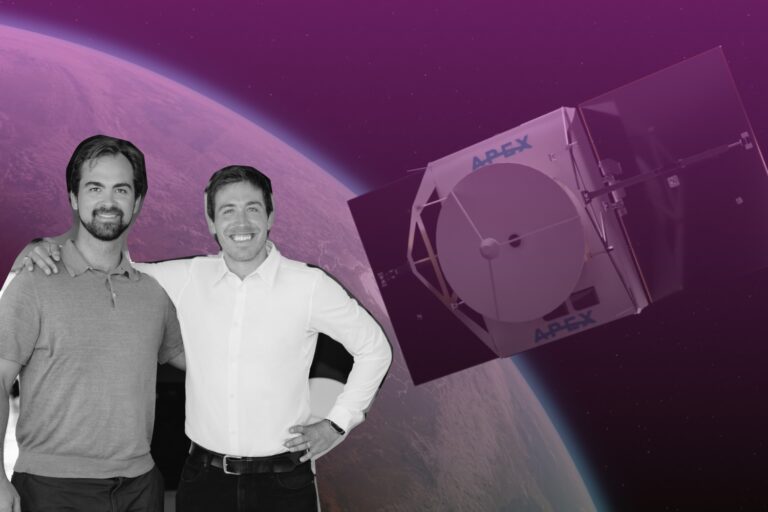
One of the Albedo’s founders – Topher Haddad, his journey into the space industry wasn’t something he planned from a young age, but he considers himself fortunate that his first job was in this field.
After graduating from UT Austin, he began his career at Lockheed Martin in the Bay Area, drawn to San Francisco for its vibrant innovation scene and his passion for engineering. At Lockheed, he engaged in system architecture and specialized in optics and imaging science, primarily working on classified remote sensing satellites for the US government.
His role involved conducting conceptual studies to address specific customer needs, such as capturing certain features or achieving precise temperature readings, and determining the best configurations of satellites and sensors to fulfill those requirements.
During his five years at Lockheed Martin, Topher developed a deep appreciation for both the technical aspects of imagery and the broader implications for national security. However, as he observed the rising momentum in the new space industry and the emergence of startups, he felt a shift.
Although he hadn’t set out to start his own company, he began exploring various startups in the industry. Then, a significant moment occurred when a former president tweeted a classified satellite image.
“So around that time, when I was starting to look in the new space world, Trump tweeted this satellite image of an Iranian missile failure, and people saw it and they were like, well, there’s a ton of detail in this image; you can see detailed characteristics about the missile and the damage, individual stair steps, all these features that you can’t really make out today with commercial satellites,” the Albedo CEO recalled.
This led to speculation that the image came from a top-secret satellite, with experts estimating its resolution at about 10 centimeters per pixel, the size of a single pixel on the ground. This revelation sparked discussions in the commercial sector about the possibilities of using 10-centimeter satellite imagery and how it could address various applications that currently require drones or planes.
However, experts cautioned that while such imagery would be revolutionary, it would likely cost between one to two billion dollars per satellite, as it would need to be the size of the Hubble Space Telescope, equivalent to a school bus.
But Topher Haddad has another idea.
“As I read that, like, kind of off the cuff, I was like, well, you could probably do it cheaper today; you could fly lower, which would shrink the size of the telescope you need,” he said.
The idea of achieving high-resolution satellite imagery kept preoccupying his thoughts, prompting him to deeply explore various related topics. This exploration, which he calls his “rabbit hole apocalypse,” involved investigating multiple facets such as technology, regulations, and market conditions.
He was trying to determine how low satellites could effectively operate while still delivering quality imagery. During this process, he realized that the emerging category of Very Low Earth Orbit (VLEO) was relevant, even though he wasn’t initially aware of it.
Very Low Earth Orbit (VLEO) describes altitudes below 450 kilometers from the Earth’s surface. Satellites operating in VLEO offer distinct benefits, as their close proximity allows them to deliver higher-resolution images and lower latency for communication.
This research led him to believe that it was possible to achieve the desired capabilities at a significantly lower cost than the experts had suggested.
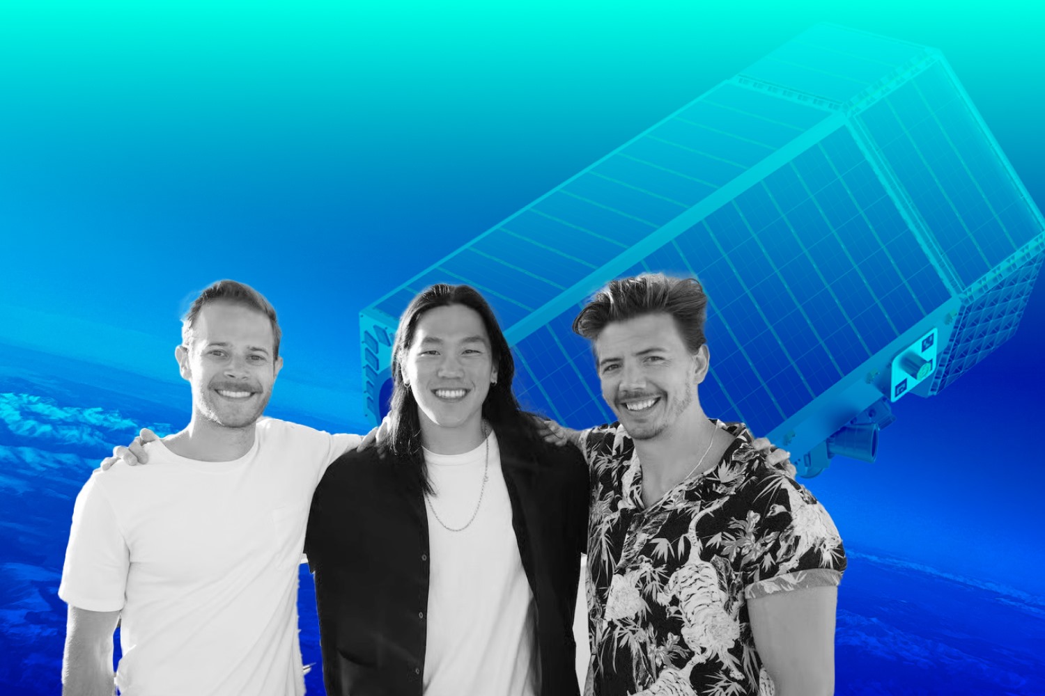
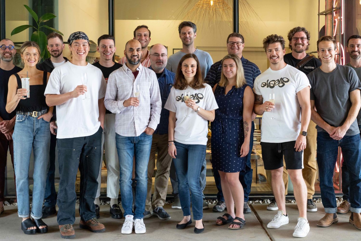
In 2021, Topher joined forces with AJ Lasater and Winston Tri to establish Albedo, aiming to provide commercial clients with 10-centimeter resolution optical images at unprecedentedly low prices.
Albedo’s VLEO Satellite Imagery and Its Use Cases
Albedo’s Very Low Earth Orbit (VLEO) satellites offer cutting-edge high-resolution imagery that is transforming several industries. According to the CEO, Albedo offers a vast array of applications that can name a few.
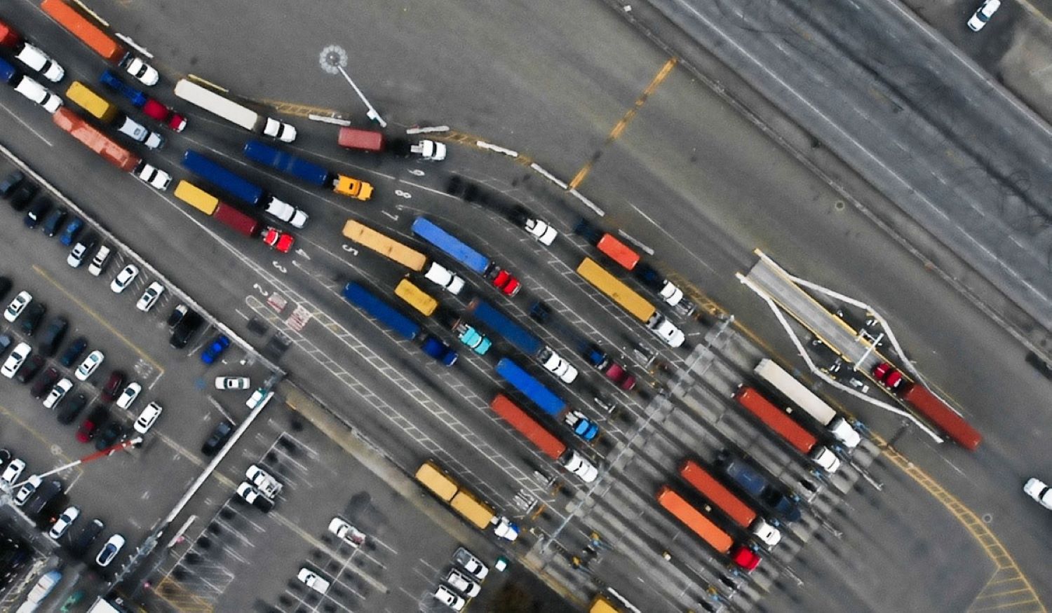
The first one is wildfire prevention for utility companies. Traditionally, utilities have relied on manual inspections, sending trucks along power lines to check for risks like dead vegetation encroaching on critical infrastructure. With Albedo’s imagery, companies can remotely monitor high-risk areas, significantly reducing the time and cost associated with field inspections and improving overall safety.
Another key application is in mapping and HD mapping. As autonomous vehicles and augmented reality (AR) technologies grow, the need for high-definition, highly accurate maps becomes more critical. Albedo’s satellites can provide the resolution necessary for these industries, enabling the creation of precise maps that are essential for the reliable functioning of these technologies.
Agriculture is perhaps the most mature use case for satellite imagery. Farmers rely on high-resolution images to predict crop yields and monitor crop health. Albedo’s satellites, equipped with thermal sensors, offer a new layer of data, allowing for the detection of irrigation issues and leaks with unprecedented accuracy. This high-resolution thermal imagery represents a significant upgrade over existing NASA satellites, which only provide low-resolution thermal data.
In the property insurance sector, Albedo’s satellite imagery provides the high-resolution images necessary for remote assessments, including tasks like roof sizing, underwriting, and evaluating weather damage. Traditionally, insurers have used aerial imagery for these purposes due to its clarity, but Albedo’s satellites can deliver the same level of detail with the added advantages of global coverage, on-demand access, and more frequent imaging.
Technological Innovations to Operate VLEO
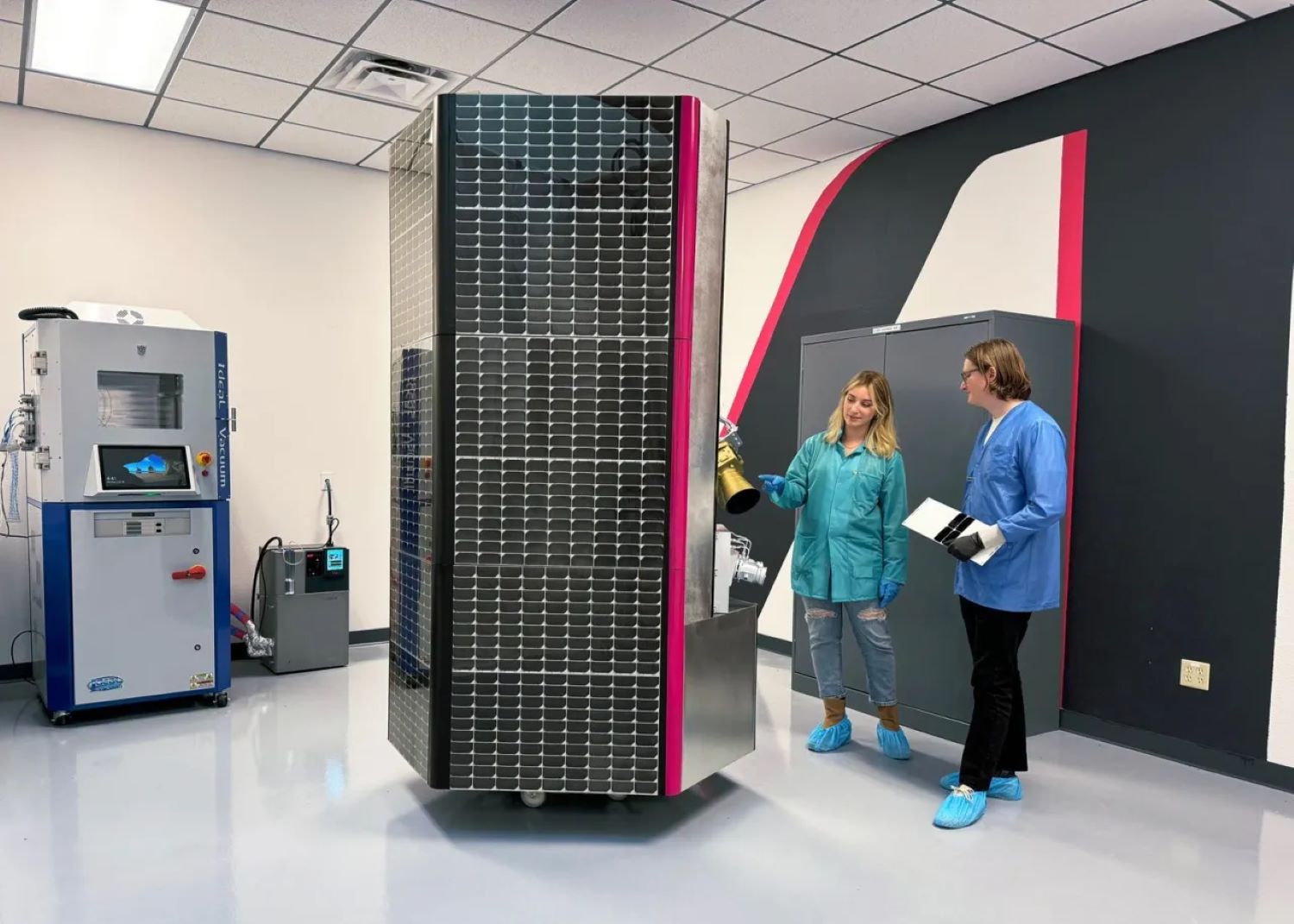
Operating in Very Low Earth Orbit (VLEO), at altitudes below 450 kilometers, demands several technological innovations to maximize the benefits while overcoming the unique challenges of such a low orbit. Albedo has their own secret sauce to successfully launching in VLEO.
“For one, everything about VLEO is based on first principles. You have to design for your environment, as with any spacecraft, and with VLEO there are specific challenges like material selection, the atomic oxygen environment, atmospheric drag, imaging orientation, data downlinking, thrusting to stay in orbit, and other complex operations,” Topher Haddad explain.
As shared by the CEO, the main challenge is the need to design the satellite specifically for the VLEO environment. This includes dealing with factors such as material selection (due to the atomic oxygen at these altitudes), atmospheric drag, imaging stability, and continuous thrust to maintain orbit. However, the most difficult aspect is achieving the pointing, control, and stability required for high-resolution imaging at such altitudes.
The challenge is that the satellite is moving at extremely high speeds (7 kilometers per second), and to capture a clear, non-blurry image, the satellite must remain precisely stable.
Additionally, it must quickly adjust its orientation to capture different targets without losing sharpness in the images. This level of precision is even more demanding because of the use of a line scanner sensor, which captures larger images but requires even greater control to produce high-quality optical images.
“This is especially challenging due to the specific type of sensor we use, called a line scanner, which enables our business model. A point-and-shoot camera would collect much smaller images at this resolution, but the pointing control and stability are critical for high-resolution optical imagery in VLEO,” he said.
Albedo is Planning Something New with AI
Artificial Intelligence (AI) is rapidly becoming a transformative force across various industries, including the Earth Observation (EO) market. As AI technology evolves, its potential applications in EO are expanding, driving innovations that enhance the speed, accuracy, and scope of satellite imagery analysis.
At Albedo, they also leverage AI to help things work better.
According to Albedo’s CEO, the role of AI, particularly super-resolution technology, in enhancing satellite imagery. Super-resolution uses algorithms to improve image clarity by boosting resolution beyond the native capabilities of the satellite.
For example, companies like Maxar use AI to enhance their 30-centimeter resolution to 15 centimeters, and his company plans to do something similar, going from 10 to 5 centimeters. However, he notes that super-resolution has limited value for real-time, immediate applications because most remote sensing focuses on understanding what’s happening now, where clarity improvements aren’t always essential.
Beyond super-resolution, he emphasizes that AI has more to offer as it evolves, particularly in improving accuracy in identifying small features in imagery, such as power lines, vehicles, or tanks.
The idea is similar to how higher resolutions improve medical imaging, where finer details provide more accurate diagnoses. As AI and computer vision advance, the demand for higher-resolution imagery will grow, helping customers gain more accurate and reliable insights from satellite data.
He elaborated on his point of view, “There is, however, some value in AI for other purposes. When it comes to information theory and resolution limits, there’s still a long way to go before we hit diminishing returns. For example, when you look at medical imaging, improvements in accuracy occur as you move from lower resolutions, like 32×32 pixels, to higher ones, like 128×128 pixels. Similarly, in satellite imagery, we’re looking at small features like power line poles, vehicles, or even battle tanks, which may only occupy a few pixels — 3×3, 10×10, or 32×32 pixels. To achieve high accuracy, we still need better resolution.”
The CEO added, “As AI continues to evolve and computer vision improves, there’s going to be a growing demand for higher-resolution imagery. This will help customers achieve greater accuracy and confidence in the data they rely on.”
Investors Join to Make Sure The Lauch of Albedo’s Satellite in 2025
In September 2022, less than a year after completing Y Combinator, Albedo announced a $48 million Series A funding round. The company has now secured an additional $35 million in Series A-1 funding at an increased valuation. Albedo’s technology has applications across both commercial and defense sectors, attracting a diverse range of investors.
Among them are Bill Gates’ Breakthrough Energy Ventures and defense-focused Shield Capital. The latest funding round was led by Standard Investments, the investment arm of Standard Industries. New participants include Booz Allen Ventures, Cubit Capital, and Bill Perkins, alongside returning investors such as Initialized Capital, Y Combinator, and Republic Capital. This brings Albedo’s total funding to $97 million.
Albedo’s CEO, Topher Haddad, noted that the Series A-1 funds would be used to launch their first operational satellite and accelerate the deployment of their constellation, marking a major step in developing the world’s first high-resolution VLEO platform. The company plans to launch its first commercial satellite in the first half of 2025.